
BayGeo
BayGeo is a non-profit organization created to help lead, mobilize, and engage the local geo-community in the Bay Area. GIS (Geographic Information Systems) is a technology used to create maps and perform spatial analysis for almost every discipline and industry. Our community includes GIS professionals, data designers, developers, artists, as well as people in biology, urban planning, transportation, utilities, marketing, nature resources, public health, and many more.
BayGeo includes several local groups: GeoMeetup, GIS Education Center, SCGIS Bay Area Chapter, SF Bay Area GIS User Group, SF Estuary Geospatial Workgroup, and South BayGeo
BayGeo Initiatives: BayGeo's Education Workgroup, BayGeo's Mapping for Social Justice, BayGeo's Open Data Workgroup, and BayGeo's Young GeoProfessionals.
BayGeo
Upcoming (1)

BayGeo's R for GIS (Part 2) (Spring 2024)
Sat, Apr 27 • 6:00 PM PDT
Check ticket price on event
BayGeo's R for GIS (Part 2) (Spring 2024)
Sat, Apr 27 • 6:00 PM PDT
Check ticket price on event
Past (142)

BayGeo's Intermediate Python for GIS (Spring 2024)
Tue, Mar 12 • 5:30 PM PDT
Check ticket price on event
BayGeo's Google Earth Engine (Spring 2024)
Wed, Mar 6 • 6:00 PM PST
Check ticket price on event

BayGeo Social Hour
Mon, Mar 4 • 5:00 PM
Free

BayGeo's Publishing Webmaps with JavaScript (Spring 2024)
Sat, Mar 2 • 9:00 AM PST
Check ticket price on event
BayGeo's ArcGIS Online Fundamentals (Spring 2024)
Thu, Feb 15 • 6:00 PM PST
Check ticket price on event
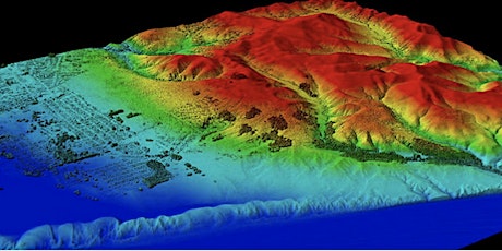
ArcGIS Pro Part 2: Remote Sensing and Raster Analysis (Fall 2023)
Wed, Nov 29 • 6:00 PM PST
Check ticket price on event

QGIS Part 2: Intermediate - Beyond the Basics (Fall 2023)
Mon, Nov 20 • 6:00 PM PST
Check ticket price on event
Publishing web maps & processing spatial data with JavaScript (Fall 2023)
Sat, Nov 4 • 9:00 AM PDT
Check ticket price on event

Python Part 1: The Basics (Fall 2023)
Tue, Oct 3 • 6:00 PM PDT
Check ticket price on event

BayGeo/USF GeoEducation Summit VI (2023)
Fri, Sep 22 • 10:00 AM
Free
BayGeo's ArcGIS Online Fundamentals (Spring 2024)
Thu, Sep 7 • 6:00 PM PDT
Check ticket price on event
Spatial Data Analysis with R: Part 2 - Intermediate (Fall 2023)
Tue, Sep 5 • 6:00 PM PDT
Check ticket price on event
BayGeo's Intermediate Python for GIS (Spring 2024)
Tue, Mar 12 • 5:30 PM PDT
Check ticket price on event
BayGeo's Google Earth Engine (Spring 2024)
Wed, Mar 6 • 6:00 PM PST
Check ticket price on event
BayGeo Social Hour
Mon, Mar 4 • 5:00 PM
Free
BayGeo's Publishing Webmaps with JavaScript (Spring 2024)
Sat, Mar 2 • 9:00 AM PST
Check ticket price on event
BayGeo's ArcGIS Online Fundamentals (Spring 2024)
Thu, Feb 15 • 6:00 PM PST
Check ticket price on event
ArcGIS Pro Part 2: Remote Sensing and Raster Analysis (Fall 2023)
Wed, Nov 29 • 6:00 PM PST
Check ticket price on event
QGIS Part 2: Intermediate - Beyond the Basics (Fall 2023)
Mon, Nov 20 • 6:00 PM PST
Check ticket price on event
Publishing web maps & processing spatial data with JavaScript (Fall 2023)
Sat, Nov 4 • 9:00 AM PDT
Check ticket price on event
Python Part 1: The Basics (Fall 2023)
Tue, Oct 3 • 6:00 PM PDT
Check ticket price on event
BayGeo/USF GeoEducation Summit VI (2023)
Fri, Sep 22 • 10:00 AM
Free
BayGeo's ArcGIS Online Fundamentals (Spring 2024)
Thu, Sep 7 • 6:00 PM PDT
Check ticket price on event
Spatial Data Analysis with R: Part 2 - Intermediate (Fall 2023)
Tue, Sep 5 • 6:00 PM PDT
Check ticket price on event
Events
BayGeo's R for GIS (Part 2) (Spring 2024)
Sat, Apr 27 • 6:00 PM PDT
Check ticket price on event
BayGeo's R for GIS (Part 2) (Spring 2024)
Sat, Apr 27 • 6:00 PM PDT
Check ticket price on event
BayGeo's Intermediate Python for GIS (Spring 2024)
Tue, Mar 12 • 5:30 PM PDT
Check ticket price on event
BayGeo's Google Earth Engine (Spring 2024)
Wed, Mar 6 • 6:00 PM PST
Check ticket price on event
BayGeo Social Hour
Mon, Mar 4 • 5:00 PM
Free
BayGeo's Publishing Webmaps with JavaScript (Spring 2024)
Sat, Mar 2 • 9:00 AM PST
Check ticket price on event
BayGeo's ArcGIS Online Fundamentals (Spring 2024)
Thu, Feb 15 • 6:00 PM PST
Check ticket price on event
ArcGIS Pro Part 2: Remote Sensing and Raster Analysis (Fall 2023)
Wed, Nov 29 • 6:00 PM PST
Check ticket price on event
QGIS Part 2: Intermediate - Beyond the Basics (Fall 2023)
Mon, Nov 20 • 6:00 PM PST
Check ticket price on event
Publishing web maps & processing spatial data with JavaScript (Fall 2023)
Sat, Nov 4 • 9:00 AM PDT
Check ticket price on event
Python Part 1: The Basics (Fall 2023)
Tue, Oct 3 • 6:00 PM PDT
Check ticket price on event
BayGeo/USF GeoEducation Summit VI (2023)
Fri, Sep 22 • 10:00 AM
Free
BayGeo's ArcGIS Online Fundamentals (Spring 2024)
Thu, Sep 7 • 6:00 PM PDT
Check ticket price on event
Spatial Data Analysis with R: Part 2 - Intermediate (Fall 2023)
Tue, Sep 5 • 6:00 PM PDT
Check ticket price on event